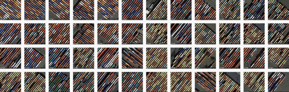
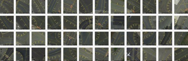
A powerful tool for artists, designers and researchers, Terrapattern lets users seek out similar-looking locations from an aerial perspective, finding connections and patterns between disparate landscapes and built environments.
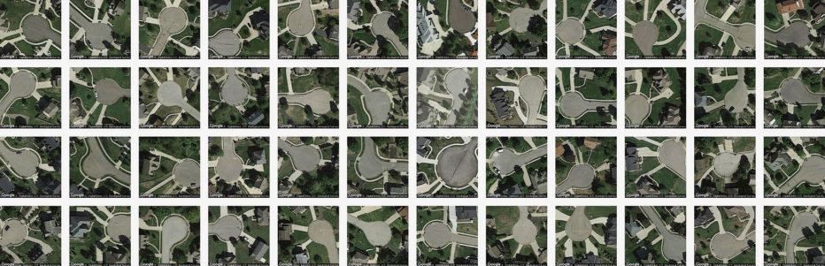
The premise is simple: start with a single place, be it a park or street, stadium or shipyard, then let the tool work its magic. The results are uncanny: colors, textures and shapes tied together by computer vision and clever algorithms. The broader use cases are infinite, but specific ones are possible too, like: a user could look for abandoned ships floating around the island of Manhattan.
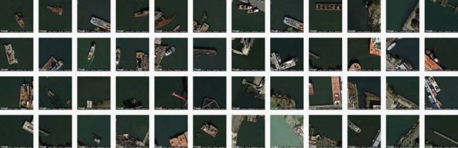
The system works by looking at its subjects in layers, looking for identifying features like curves, edges and shadows that indicate height. In a way, its task is similar than some pattern recognition software since it is not called upon to identify the subject, just match it.
“For our purposes,” explain the creators, “‘interesting’ features are anthropogenic or natural phenomena that are not only socially or scientifically meaningful, but also visually distinctive—thus lending themselves ideally to machine recognition. Examples could include things like animal herds, methane blowholes, factories, destroyed homes, or logging roads. Many other patterns await discovery.”
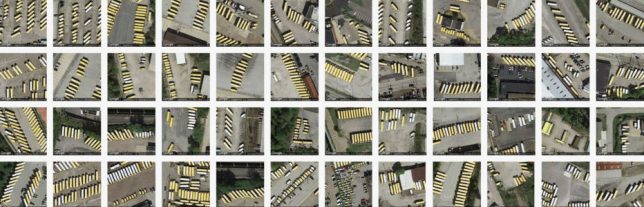
The system draws on data from OpenStreetMap, combing through hundreds of thousands of images looking for something like whatever you submitted. Researchers can use tools like this to monitor natural habitats or make archaeological finds, but ordinary people can employ this tool to create art or make inquiries about the cities they live in. Even a quick tour around the engine reveals emergent macro-patterns from individual tiles, some worthy of wall art treatment.
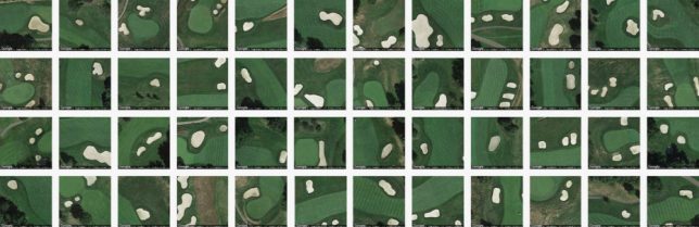
Terrapattern’s creators are indeed excited for more non-standard and unexpected uses: “Terrapattern is ideal for discovering, locating and labeling typologies that aren’t customarily indicated on maps. These might include ephemeral or temporally-contingent features (such as vehicles or construction sites), or the sorts of banal infrastructure (like fracking wells or smokestacks) that only appear on specialist blueprints, if they appear at all.”