
What if we could make alternative transportation ultimately faster, cheaper and more convenient than personally-owned cars, the dominant transport devices of the 20th Century? The sharing economy has opened new possibilities for commuters and travelers, but integrating this dizzying array of options together with public transport is an essential next step in this ongoing paradigm shift.
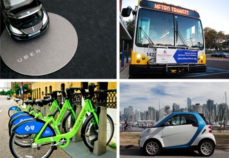
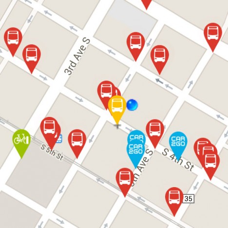
OMG Transit is a Minneapolis-based startup that provides free, fast and simple sets of options for getting from your location to your destination without a personal car, be it by bus, shared bike (NiceRide in the case of the Twin Cities), shared car systems like Car2Go or ZipCar or private rides along the lines of Uber or Lyft. Available as an iPhone or Android application, OMG also offers a web app version – all with no cost to the user.
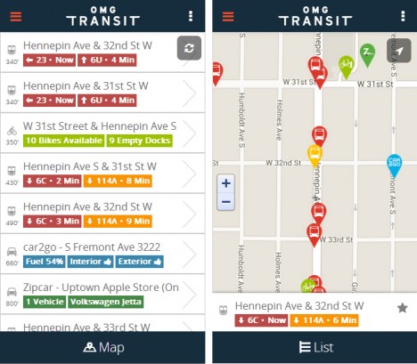
Boasting a beautifully-designed interface with attention to usability, color and detail, their free-for-all approach is aimed at helping them grow faster than the competition. Their team, headed by entrepreneur and technologist Matt Decuir, has its sights set first on major cities around the US and then the world (perhaps space thereafter).
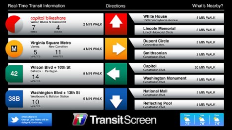
More focused on next-step options than A-to-B directions, TransitScreen started out displaying realtime transit data in residential, commercial and institutional building lobbies. Their boards show people up-to-the-minute information on subways, commuter trains, buses, bike share, ride shares in cities around the United States.
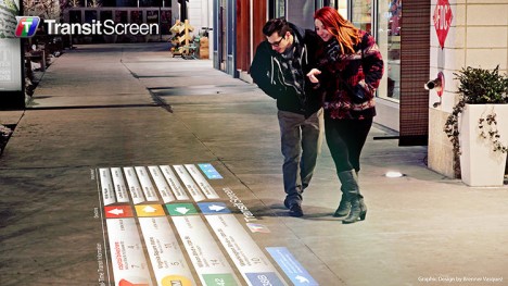
Now, with SmartWalk, this same company has taken to the streets (or rather: sidewalks and walls) outside of offices, apartments and universities, projecting this data onto public surfaces for the benefit of anyone passing by. The data includes color-coded transit option types and times but also wayfinding cues regarding directions and distance.
Other players in this space include Roadify and RideScout, though not all offer options for all devices or for every type of regional transport. Some, like Google Maps in its current form, have broader reach but focus more on public transportation schedules (their acquisition of Waze is a step toward realtime data, albeit for personal cars). Whatever system(s) triumph, the goal is a worthy one: reducing friction in the use of alternative transit options to the point where taking, for instance, a bus to a bike to a shared car is easy, fast and cheap enough to obviate the need for a fully-owned automobile.