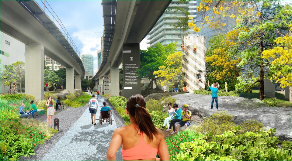
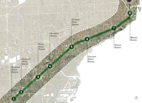
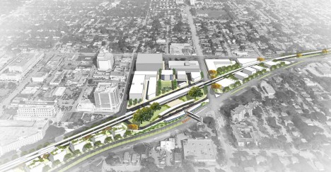
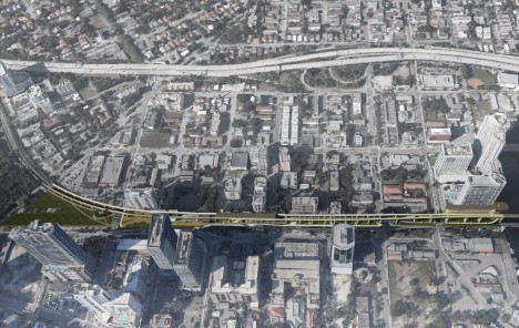
Following in the footsteps of the High Line (and Low Line) of New York City, the Underline project aims to take the underutilized space below Miami’s elevated MetroRail and transform it into a connected park-and-pathway system spanning ten miles and hundreds of acres.
The undertaking is ambitious, but it has solid precedents around the country: “The Underline will connect communities, improve pedestrian and bicyclist safety, create over a hundred acres of open space with restored natural habitats.”
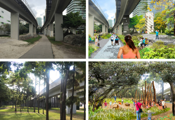
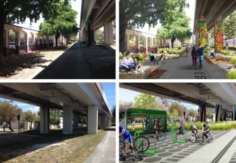
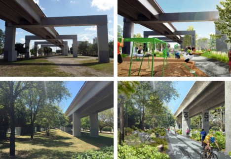
Before-and-after concept images, shown above and below, highlight key points along the trail, including expanded park space, bicycle repair stations and play areas.
Connecting Miami, Coral Gables and South Miami, the design further aims to “encourage a healthy lifestyle, provide an easily accessible place to exercise, create a mobility corridor that integrates transit, car, biking and walking, provide a 10-mile canvas for artistic expression, attract development along US1, and generate significant economic impact.”
Beyond its immediate and direct effects, the trail would also connect out to a system of existing bike paths as well as ones under development, serving as a nexus between a total of 250 miles of extant and proposed trails across southern Florida.
James Corner Field Operations of New York City was selected to create the master plan for The Underline, with input collected from surveys and six public meetings.
Their master plan provides “standards and requirements for the urban trails including trail widths and proposed materials. It also includes recommendations for lighting and wayfinding, seating, amenities, etc. The plan proposes improvements to crosswalks, intersections. Landscape recommendations include a plant palette and placement. There are also proposals for destination parks.”